Showing posts with label canal. Show all posts

Wednesday, February 8, 2012

C&O Canal: Billy Goat Trail, Section C, Carderock

Billy Goat Trail, Section A is one of the most popular hiking trails in the DC area.  But this post is about Billy Goat Trail, Section C which I like equally as much.  The closest parking lot for this trail is 2 miles from the beltway at the Carderock Recreational Area on the C&O Canal.  Here are some pictures from my recent hike:

Billy Goat Trail - Follow the blue markers

Learned how to climb with ropes when I was younger here.

Views of a quiet side stream of the Potomac River

Follow the markers!

Beautiful overlooks all along the trail.

The sweeping current of the Potomac River

Rushing rapids

Rapids in the Potomac River provide beautiful background sound while hiking!

Woodpecker - I had to super zoom to get this!  Disclaimer: I am not a bird watcher.

Tidewater pond

The DC Beltway!

Me :o)

Unofficial east end of Billy Goat Trail, see the Beltway down the towpath.

Lock 14 just north of the Beltway


Lucky Lock 13 is under the Beltway!  All the times I've driven over it and didn't know...

Official East End of Billy Goat Trail, Section C.  I followed the trail further to an unofficial exit along a creek.


Monday, February 6, 2012

C&O Canal: Swains Lock to Great Falls

Growing up in the Washington, DC area has given me the pleasure of a lifetime of memories at the C&O Canal.  This canal is 185 miles long and it starts in Georgetown and goes all the way along the Potomac River west through Maryland.  

I've learned how to canoe, bicycle, and rock climb along the different section of the C&O Canal's towpath.  I would love to eventually share information on all the different sections of the canal.  There is so much history to see and experience in addition to all the different sporting activities you can do along the towpath.  

Here are a couple winter time pictures I took walking along the section from Swains Lock to Great Falls.  There are nice opportunities to view the Potomac River along this section.  Swains Lock has free parking and is around 2 miles from Great Falls where the parking costs money.  So if you're a walker and you want to see the falls for free, park here and hoof it!


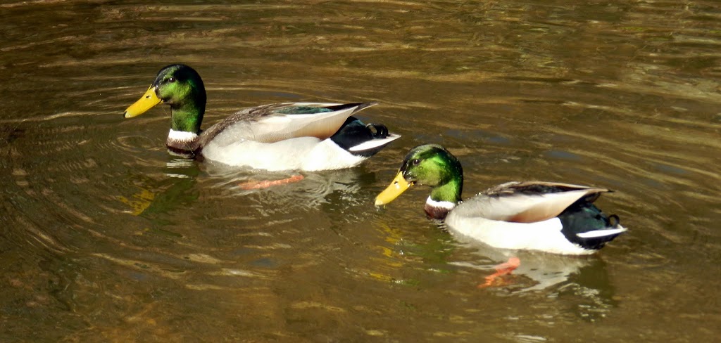
Lots of Ducks!

Duck Bums!
An odd patch of bamboo... ??

Bald Eagle
Rocks along the canal
Birds

Thanks for reading!  If you have a National Parks Passport Book, then you should visit the Great Falls Visitor Center for a stamp.  

For more information about visiting the C&O Canal: http://www.nps.gov/choh

Monday, October 3, 2011

C&O Canal: Riley's Lock

Riley's Lock is one of the many places along the C&O Canal that you can park to access the towpath.  The C&O Canal is a National Park with 134 miles of trail which starts in Washington DC and follows the Potomac River west.  
Aqueduct at Riley's Lock
 Riley's Lock has a small boat ramp so recreational boaters and fishers can access the Potomac River.  The ramp is on Seneca Creek, giving boats a gentle start before they enter the fast currents of the Potomac.  These pictures were taken when the creek and river were both very swollen from a week of non-stop rain.
Side wall of the Aqueduct

Riley's Lock House

View of Seneca Creek from the Aqueduct

View of swollen rapids on the Potomac River from C&O Canal towpath

Swollen Potomac waterfall near Violette's Lock

Brave kayaker

Violette's Lock, just south of Riley's Lock

Paddle Boarders enjoying the peaceful C&O canal

Potomac River, overflowing it's bank all the way to the retaining wall.

Potomac River, You can see how high the water is.  Poor bushes..

Lovely C&O Canal

Reflective waters of the C&O Canal

Towpath along the C&O Canal

Seashells so far from the sea!


For more information on visiting the C&O Canal, visit: http://www.nps.gov/choh